Browse
AI Directory Open Source AI News 🏆 AI Challenge AI Statistics
Browse by profession
Accounting, Bookkeeping & TaxCompliance, Audit & GRCConstructionCustomer SupportData ScienceMedical All 38 professions →
Company
About Advertise Submit a tool Get the free Energy AI guide
Overview Before & After Try It Reviews Screenshots Why This Tool FAQ Pricing Top 10 Get Alerts News

Use satellite imagery and AI to manage critical infrastructure, reduce vegetation management costs, and mitigate climate risks.

AiDash provides a unified platform for asset inspection, risk assessment, and biodiversity management for utilities and energy companies.

DifferentiatorSatellite-first AI analysis for system-wide asset visibility.
ProofReduces vegetation costs by 20%; used by 185+ companies.
Explore AiDash
Pricing on request
8.8 Zekai
Enterprise Satellite-AI for Utilities
AI for Energy & Sustainability
Ease of Use
7.8
Accuracy
9.2
Value
8.8
Time Saving
9.4
185+Users
8.8/10Zekai Score
Satellite AnalyticsVegetation ManagementWildfire MitigationClimate Risk AIAsset Monitoring
🏷 Is this your tool? Claim this listing →

Zekai Verdict

What is it?
AiDash is a satellite-first AI platform for Energy & Sustainability professionals to manage geographically distributed assets.
Best for
Best for large-scale utility and energy operators needing to optimize vegetation management, monitor asset integrity…
Not ideal for
Pricing is not transparent and requires a direct sales inquiry.
Price
Pricing on request
Zekai Score
8.8/10
Hand-scored by Zekai

Top AI for Energy & Sustainability picks

See all 101 AI tools for Energy →
⚡ Quick answer

For energy and sustainability professionals, AiDash is a leading AI platform that uses satellite imagery to optimize critical infrastructure management. It provides actionable data to reduce vegetation management costs by up to 20%, improve grid reliability by 10%, and proactively mitigate climate risks like wildfires and storms across vast operational areas.

CategoryAI Infrastructure Management
Best ForUtilities optimizing vegetation and risk management.
Price FromOn request
FreeNo
DifferentiatorSatellite-first AI analysis for system-wide asset visibility.
ProofReduces vegetation costs by 20%; used by 185+ companies.
Rating4.4/5
📖 About AiDash
Real Impact

Before & After

❌ Before

Relying on slow, expensive, and incomplete manual ground surveys for asset and vegetation management.

Cycle-based maintenance
✅ After

Gaining a complete, system-wide view of all assets and risks from satellite data, updated regularly.

Data-driven, risk-based maintenance
Prompt Templates

Try it with these prompts

Copy any prompt and paste it directly into the tool.

Analyze wildfire risk for a specific region

Analyze the wildfire risk for the [Region Name] area. Provide details on vegetation conditions, fuel load, and moisture levels. Recommend proactive vegetation management strategies and defensible space creation for [Spec…

Predict storm outage impact and crew deployment

Predict the potential storm outage impact for the [Geographic Area] region over the next [Number] hours. Identify critical assets at risk and recommend optimal crew pre-positioning strategies for [Specific Storm Type, e.…

Assess vegetation encroachment on power lines

Assess vegetation encroachment risks along the [Specific Corridor/Line Name] power line. Use VHR satellite data updated up to 12x per year to identify areas of concern and suggest optimal trimming schedules to prevent [S…

Social Proof

Trusted by 185+

185+ professionals using this tool
Ease of Use
7.8
Accuracy
9.2
Value
8.8
Time Saving
9.4

"The ability to image our entire system and to know everything all at once — that is incredibly powerful."

David J., Wildfire Resiliency Plan Manager · June 2026

"A time-based cycle approach prune plan is best practice today, but a data-driven, optimized approach will soon be the industry’s best management practice."

Bertram S., Vegetation Strategy Manager · May 2026

"The platform is powerful for strategic planning, but the satellite data refresh rate can sometimes lag behind fast-changing ground conditions. We still need targeted field verification."

Maria K., GIS Analyst · April 2026

"The quality and accuracy of the AiDASH habitat mapping is the best I have seen to date... This is a paradigm shift for the future of mapping and monitoring habitats."

Dr. David S., Natural Water Resources Team Manager · March 2026
Proof of Use

Inside AiDash

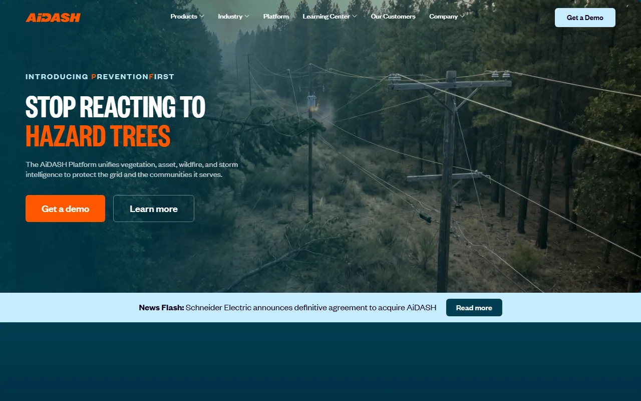
AiDash screenshot — interface view 1

Captured by Zekai from the live AiDash interface during review.

185+ professionals are already using this tool.
See Plans & Pricing →
Comparison

How it compares

AiDash vs. Traditional Methods: The primary alternative to AiDash is the traditional approach of manual ground surveys, helicopter patrols, and cycle-based maintenance schedules. While traditional methods offer direct, on-the-ground validation, they are slow, expensive, and provide an incomplete picture of the entire system. Choose AiDash when you need a comprehensive, data-driven, and proactive view of your entire asset network to optimize budgets and mitigate risk at scale. Stick with traditional methods for highly targeted, small-scale projects where a satellite-integrated system is not feasible.

The decision

Is it worth it?

Return on investment
By reducing vegetation management costs by up to 20% and improving reliability by 10%, AiDash provides a clear ROI for large utilities, despite its enterprise-level investment.
Built for
Vegetation Managers, Wildfile Resiliency Planners, Asset Managers, and Sustainability Officers in the electric utility, gas, energy, and water sectors.
Effort to adopt
Enterprise System
Compliance
Compliance posture not publicly documented — verify with vendor.
Who It's For

Why Energy & Sustainability choose this tool

🎯
Built for
Best for large-scale utility and energy operators needing to optimize vegetation management, monitor asset integrity, and proactively mitigate climate risks across vast territories.
In-Depth Overview
AiDash transforms utility and energy asset management by replacing slow, expensive ground surveys with a comprehensive, satellite-powered AI platform. For sustainability and operations leaders, this means moving from a reactive, cycle-based maintenance schedule to a proactive, risk-based approach. The platform provides a single source of truth for all assets, accessible from the C-suite to field crews, ensuring data is both actionable and compliant. Proof of its effectiveness lies in quantifiable outcomes: AiDash users can improve system reliability by 10%, reduce vegetation management expenses by 20%, and cut land and air sustainability survey costs by 70-90%. With over 185 companies, including Fortune 500 utilities, using its products like the Intelligent Vegetation Management System (IVMS) and Climate Risk Intelligence System (CRIS), AiDash enables you to make smarter, data-driven decisions that enhance safety, reduce costs, and bolster climate resilience.

Key Use Cases

🌳
Optimize tree trimming cycles and reduce costs
Vegetation Manager
Use the Intelligent Vegetation Management System (IVMS) to move from a time-based to a data-driven pruning plan, targeting only high-risk areas identified by AI.
20% reduction in vegetation costs
🔥
Proactively identify and manage wildfire risks
Wildfire Mitigation Planner
Leverage the Climate Risk Intelligence System (CRIS) to analyze climate and vegetation data, identifying critical zones and prioritizing mitigation efforts before fire season.
Improved system-wide resiliency
🌍
Manage and report on biodiversity programs
Sustainability Officer
Employ the Biodiversity Net Gain (BNG AI) system to remotely map and monitor habitats, verifying biodiversity commitments for regulatory reporting.
70-90% reduction in survey costs
✓ Pros
Reduces vegetation management expenses by up to 20%.
Improves grid and asset reliability by up to 10%.
Provides a unified view of assets from C-suite to field.
Uses high-resolution satellite imagery for comprehensive system analysis.
Supports regulatory compliance and stakeholder reporting.
· Cons
Pricing is not transparent and requires a direct sales inquiry.
Primarily designed for large enterprises, likely unsuitable for smaller organizations.
Requires significant integration with existing asset management systems.
Effectiveness depends on satellite data quality and refresh rates for specific regions.
⚡ Editorial Verdict

AiDash offers a powerful, satellite-first approach to infrastructure management that delivers quantifiable cost savings and reliability improvements. Its strength lies in unifying disparate data sources into a single, actionable view for risk management. The main trade-off is its enterprise focus, which requires significant integration and is not suited for smaller operators.

Questions & Answers

Frequently asked questions

What is the best AI tool for utility vegetation management?

+
AiDash's Intelligent Vegetation Management System (IVMS) is a top contender, using satellite data and AI to shift from time-based to data-driven, risk-based pruning plans, which can reduce vegetation management expenses by up to 20%.

How can AI and satellite imagery help in wildfire mitigation for energy companies?

+
AiDash's Climate Risk Intelligence System (CRIS) analyzes satellite imagery, weather data, and asset information to identify high-risk zones. This allows utilities to proactively manage vegetation and harden infrastructure to mitigate wildfire threats before they escalate.

Which software can help reduce utility operational costs using AI?

+
AiDash is designed to deliver significant cost reductions. The platform claims to reduce vegetation management expenses by 20% and land and air sustainability survey costs by 70-90% by replacing manual inspections with AI-powered satellite analysis.

Can AI help with biodiversity net gain (BNG) monitoring and reporting?

+
Yes, AiDash offers a Biodiversity Net Gain Management System (BNG AI™). It uses remote sensing to provide habitat mapping that is comparable to traditional ground surveys, streamlining the process of monitoring and reporting on BNG commitments.

What are the top AI platforms for managing distributed energy assets?

+
AiDash is a leading platform for managing geographically distributed assets. It provides a unified view for electric, gas, water, and other energy utilities to monitor assets, manage vegetation, and assess climate risks across their entire system using satellite data.

Is AiDash available in the US?

+
Yes, AiDash operates across all 50 U.S. states. The company serves over 185 customers across 5 continents, including major US utilities.

Last reviewed:

Plans & Pricing

Start today

Enterprise
Pricing on request
Tailored for teams and large organisations.
Contact Sales

Prices and features are updated regularly but can change at any time — always confirm on the official website. Some links on this page are affiliate links.

See all 101 AI tools for Energy →
Free guide

Take it with you

  • Understand the limitations of cycle-based vegetation management.
  • Discover how satellite imagery provides a complete system view.
  • Learn how AI prioritizes risk across millions of assets.
  • Calculate your potential ROI in cost savings and reliability gains.
  • See how to use data for regulatory compliance and reporting.
+3 more steps inside the guide
Send me the full guide

Get AiDash deal alerts

Be the first to know when AiDash drops a new discount, adds features, or changes pricing.

Exclusive AiDash discount codes
New feature announcements
Best alternative picks when pricing changes
Zero spam — unsubscribe anytime
🎉
You're subscribed!
We'll notify you when AiDash has a new deal.
AI Directory

About AiDash

Full Description

AiDash is a satellite-first AI platform for Energy & Sustainability professionals to manage geographically distributed assets. It helps utilities and energy companies improve reliability, reduce vegetation management expenses, and implement data-driven climate risk mitigation strategies.

Editorial Verdict

AiDash offers a powerful, satellite-first approach to infrastructure management that delivers quantifiable cost savings and reliability improvements. Its strength lies in unifying disparate data sources into a single, actionable view for risk management. The main trade-off is its enterprise focus, which requires significant integration and is not suited for smaller operators.

Last reviewed:
Disclaimer
Zekai is an independent AI tools directory. We are not affiliated with, endorsed by, or officially connected to AiDash unless clearly stated. All product names, logos, and brands are the property of their respective owners and are used for identification purposes only. The information on this page — including pricing, features, and availability — is general information, may have changed since our last review, and is not professional advice. Zekai Scores and verdicts are our editorial opinion. Some outbound links are affiliate links that may earn us a commission at no extra cost to you. Spotted outdated or incorrect information? Request a correction →
Previous Tool LineVision Next Tool Overstory
Watershed
SPONSORED AI FOR ENERGY & SUSTAINABILITY
Watershed
Accelerate sustainability programs with data-driven insights
Visit Site → Learn more
All AI Tools A–Z →
Visit website ↗
AiDash8.8Try AiDash ↗Next tool →
Today's top 3 AI for Energy & Sustainability tools →

See Zekai first in Google