
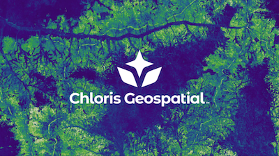
Measure forest carbon stock and change anywhere on Earth using 25 years of satellite data for high-integrity carbon market and supply chain reporting.
Quantify above-ground biomass, monitor emissions from deforestation, and track removals from restoration with pixel-level uncertainty.
What is Chloris Geospatial?
Chloris Geospatial: Measure forest carbon stock and change anywhere on Earth using 25 years of satellite data for high-integrity carbon market and supply chain reporting. No free plan. Zekai scores it 7.5 out of 10 after independent testing. Best for validating carbon project integrity and supply chain impacts.
Zekai Verdict
- What is it?
- For energy and sustainability professionals, Chloris Geospatial provides high-resolution forest carbon data derived from 25 years of satellite imagery.
- Best for
- Best for organizations requiring independently validated, high-resolution data to assess the integrity of forest carbon…
- Not ideal for
- Pricing is not public, requiring direct contact and likely a significant budget.
- Price
- Pricing on request
- Zekai Score
- 7.5/10
 Kraken
 Enverus
 Aurora Solar
 Climatiq
 AiDash
 Jua
Jua IBM Maximo 9.1
Chloris Geospatial is a top AI tool for Energy & Sustainability professionals needing to verify nature-based solutions. It provides independently validated, high-resolution forest carbon data spanning 25 years, allowing users to accurately quantify biomass, monitor deforestation, and assess the integrity of carbon projects for investment and compliance.
Your workflow, automated
Before & After
Relying on outdated or unverified project-reported data for carbon accounting.
High due diligence uncertaintyIndependently verifying carbon project integrity with validated, satellite-derived data.
Data-driven investment decisionsTry it with these prompts
Copy any prompt and paste it directly into the tool.
Provide a specific geographic area of interest. I need to understand the above-ground biomass stock and related carbon stocks for this region.
I need to monitor annual emissions from deforestation and degradation in [specific region]. Please provide data on forest area losses and their associated biomass and carbon impacts for the past year.
For the [restoration project area], quantify the carbon removals achieved through restoration and reforestation efforts. I require data on forest area gains and their related biomass and carbon impacts.
Prompts for Energy
Trusted by professionals
Chloris Geospatial integrations
Best Chloris Geospatial alternatives
While both Chloris Geospatial and Pachama use satellite data to monitor forest carbon, they serve different primary functions. Choose Chloris when you need raw, high-resolution historical data and pixel-level uncertainty metrics for deep, in-house analysis and custom model building. Its strength is providing the foundational data for your own due diligence. Pick Pachama for a more end-to-end platform experience, connecting project developers with carbon credit buyers and offering a more managed project evaluation and monitoring service. Chloris is for data-first teams; Pachama is for market access.
Is Chloris Geospatial worth it?
Why Energy & Sustainability choose this tool
Key Use Cases
Chloris Geospatial provides an essential layer of data integrity for nature-based solutions, using historical satellite data to quantify biomass and carbon flux. Its strength lies in providing pixel-level uncertainty and independent validation, which builds trust in carbon accounting. The primary trade-off is its focus on specialized, large-scale analysis; it is not a tool for casual use, and pricing is only available upon request, suggesting a significant investment.
Frequently asked questions
Which AI tool is best for verifying carbon credits from forestry projects?
How can I monitor deforestation in my company's supply chain using satellite data?
How does Chloris Geospatial measure above-ground biomass?
Can I get historical forest carbon data for ESG reporting?
Which platforms provide validated data on carbon stock changes for investment due diligence?
How to assess the integrity of a forest carbon project's baseline claims?
Last reviewed:
Chloris Geospatial pricing and plans
Prices and features are updated regularly but can change at any time — always confirm on the official website. Some links on this page are affiliate links.
Top 10 AI tools in this category
Take it with you
- Understand the difference between project-reported and satellite-verified data.
- Key metrics to look for: Above-Ground Biomass (AGB), deforestation rates, and uncertainty.
- How 25+ years of historical data establishes a credible project baseline.
- Applying Chloris data for carbon market due diligence (e.g., VM0047 projects).
- Using forest data for Scope 3 and supply chain emissions reporting.
Get Chloris Geospatial deal alerts
Be the first to know when Chloris Geospatial drops a new discount, adds features, or changes pricing.
More on AI for Energy & Sustainability
- Boosting Solar ROI: What ISC Konstanz’s Pilot Line Means for Energy Professionals
- ACEN’s Solar Surge: What It Means for Every Energy Professional
- Best Free AI Tools for Energy Professionals: What Works (2026)
- The 12 Best AI Tools for Energy Professionals (2026)
- AI for Energy: The Complete 2026 Guide (Tools & Workflows)
Latest AI news

About Chloris Geospatial
Full Description
For energy and sustainability professionals, Chloris Geospatial provides high-resolution forest carbon data derived from 25 years of satellite imagery. It enables you to quantify above-ground biomass, monitor annual emissions from deforestation, and track carbon removals from restoration projects. This empowers confident assessment and investment in nature-based solutions for carbon markets and supply chain management.
Editorial Verdict
Chloris Geospatial provides an essential layer of data integrity for nature-based solutions, using historical satellite data to quantify biomass and carbon flux. Its strength lies in providing pixel-level uncertainty and independent validation, which builds trust in carbon accounting. The primary trade-off is its focus on specialized, large-scale analysis; it is not a tool for casual use, and pricing is only available upon request, suggesting a significant investment.


